Categories
News Tech

Google Maps Update Download Available with Improved Features from Waze

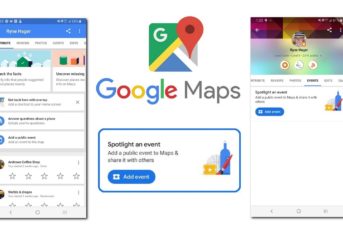
We already know that Google is trying to improve Google Maps by getting some features from Waze. Since Google owns Waze, it is a simple and smarter move to do that. So the more information we have on Waze or Google Maps, the more and better users will be informed about the traffic ahead and other obstacles. The novelty on Google Maps is the fact that the company wants to use the same approach from Waze.

What New Features We Have on Google Maps from Waze?

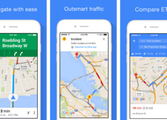
If you are a Waze fun and haven’t tried Google Maps, maybe now is the time to give it a shot. Now Google Maps have speed limits, speed traps, reports about your current traffic experience, and warning about traffic and accidents ahead of you.  The incident report feature will be rolling out soon in Google Maps, and you will see it once the feature will be brought to your market.

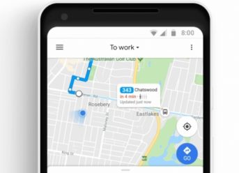
However, Google Maps is a great navigation tool for public transport and daily needs. The device will give you suggestions about the fastest route to your destination, will provide navigation details about trains or buses in case you need to change them. The newest improvement is the features were Google Maps will tell you if a train or bus has available seats. This will be done with the help of other users, by asking them if the train/bus is crowded or not. Improving Google’s algorithms with this question, it improves your future journey as well.

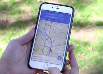
Also, if we look back to last year, a similar feature has been announced for Sydney, and this will probably be the case to more markets in the future. So far, the feature has started to appear on Android and on iPhone from months ago. Google Maps is sending alerts on various users from different regions of the world, like the US, Europe, and Asia.

Categories
News Tech

Add Public Events on Google Maps: Android Feature Goes Live

For those that use Google Maps regularly, you might have noticed a handy feature that appeared in the Android app.

Google Maps for Android now lets users add a public event in the Contribute Tab. Using Google Maps’ new feature can let business and event managers make public their next events without the need of paying for advertising. It takes nearly 30 minutes to make that event live once it was added on Google Maps.

The new feature is only available for Android users at the moment. Now let’s see how you can set your public event in the short guide below.

Google Maps: Add a Public Event

Looking at the support page from Google, we can see that the feature is not live in all regions, so if you don’t see it, then you’ll have to wait for your region to be added. To see the option and add a public event, follow the next steps:

  • open Google Maps on Android -> go to the tab Contribute -> tap on Events, then tap on Add a public event.

In there, you will get a few choices: you can tag the location, add the event name, and the time and date of the event.

The option also lets you add an image and write more details about the event and even describe it. However, there have been reports of the image option being unresponsive.

Save the event, and if you want, even after you have created the event, you can edit or delete it by going to:

  • Contribute -> Events -> Select your event -> Edit this event / Delete this event.

We don’t know yet if this feature will be globally available or if it will also go live on Google Maps for iPhone users.

Google Maps Changes, New Features and More

According to Debate Report, Google Street View now lets you watch “Mars on Earth,” and it’s definitely not what we expected.

Google has also made a few changes to the Maps for Android, reintroducing city, state and country borders, after being removed a few months ago. When a user searches a city, state or country, they will see the borders highlighted with red. According to reports, this border feature has appeared in version 10.12.1.

Categories
News Tech

Google Maps Update Download Available with ETA features for iPhone

One of the most useful updates received by the Google Maps iOS has added the excellent ETA function.

The ETA share feature allows users to seen their real-time route to select contacts. This will help larger groups to coordinate, as they will know when the others arrive and how much it will take.

When announcing the function for the iPhone, Google Maps product manager Samuel Mclean noted that the option aims to facilitate group trips, while also keeping you safe and focused on the road ahead. After navigation is started, you can share your ETA, location and route by tapping on the ˄ button and selecting the ‘’Share trip progress’’ optic. A window will appear, and you will be able to select the desired contacts from a favorite list, or by manually searching for specific names.

The feature can be used while walking, driving or cycling and it can be useful in a variety of situations. Let’s say that you are meeting your plan for a drink and you are late. Letting him know how much it will take for you to arrive will allow him to do something else in the meantime while also observing your path and knowing exactly when you will arrive at the designated meeting point.

The update allows the location-sharing feature to be used with other third-party apps like Facebook Messenger and WhatsApp. After you reach your location the function will be automatically stopped in order to conserve battery and maintain your privacy.

The function is nothing new, as it was already available on apps like Waze and Glympse but it makes a difference on the Google Maps app, which is still the most popular mapping app in the world.

Another function that may come in handy is the commute option, which allows users to create detailed allows you to create a commute plan, in order to optimize your daily travel times.

Categories
Tech

New Google Maps Update Now Shows Electric Vehicle Charging Stations

Earlier this week, Google announced a new Google Maps update that makes it possible to locate electric vehicle charging stations. The new feature comes right after the addition of the group planning option for choosing and rating on a restaurant and the new Reserve function to assist people in booking for activities and tables at favorite diners.

The upcoming Google Maps update helps people locate the closest EV charging stations. It’s ideal for electric vehicle owners who can now find charging stations while on the road.

To locate electric vehicle charging stations, all you have to do is to search using terms like “EV charging,” “EV charging stations,” “Electric car charging stations, or derivatives of the three. Google Maps would return a map showing you the nearest such station. You must have your smartphone’s Location setting activated to let Google now your position to retrieve the closed EV charging stations.

New Google Maps Update Now Shows Electric Vehicle Charging Stations

Once you’ve located a station, just tap on it, and Google Maps will show you additional information, including how many ports are available, how fast is the charging, customer ratings, images, and so on.

Google Maps is now helping you locate Tesla and Chargepoint electric vehicle charging stations, worldwide. However, in the US, the app is also revealing SemaConnect, EVgo, and Blink stations. For the UK drivers, new Google Maps update can pinpoint Chargemaster and Pod Point stations, while people in Australia or New Zealand can find Chargefox stations.

As the electric car market is growing more and more, many electric vehicle drivers wonder where they can find charging stations. Until now, especially for those who are much time on the road, locating an EV charging station was challenging. Now, thanks to the new Google Maps update, users can pinpoint the nearest electric vehicle stations, depending on drivers’ location.

Categories
News Tech

Google Maps Update Download Available with Location Sharing Improvements

Google Maps is one of the apps that are used all around the globe. In 2017 it enabled us to share our location almost in real time with those close to us (as in family and friends, not necessarily in the proximity of us). Switch the calendar to our time and right now Google Maps made it possible to share not just where you are but also how much battery you have left on your phone.

Of course, you might wonder why it is so important to know the battery status of someone. Well, ponder a bit upon it. There are many apps that are capable of sharing location. However, when you run out of battery, those apps are rendered useless, sitting in wait until you are able to reconnect. That’s when you start to worry about your friend and wonder if they don’t have signal, maybe they lost their phone or perhaps someone has stolen it.

That’s why it may be incredibly useful and mind assuring to see someone’s battery status along with their location. When you see that your friend’s phone is about to die, you at least know what are the reason for his sudden silence.

We knew since February that this change on Google Maps was coming. We owe thanks to those at AndroidPolice that spotted this update in the Google Maps APK teardown available then. Since then, more and more people spotted this change on their app, although only now it will be available for almost everyone. Back then there were people who only saw this battery status notification when its level was low.

While it is a completely useful update, Google isn’t the first company to have thought of this. Zenly, who was recently bought by Snapchat, changed its app to include a similar feature all the way back in 2016.

Exit mobile version