Categories
News Tech

Google Maps Will Receive An Incognito Mode

Many Chrome users are already familiar with the Incognito Mode offered by the Chrome browser. The feature allows you to navigate on the internet without saving a history, cache or other elements that can be tracked. In recent years, Google worked hard to improve the privacy and security features of the Android OS. The YouTube app received an update which allows users to use the Incognito Mode in 2018 and the functionality will be expanded to another app.

During the keynote held at the I/O conference which started on May 7th, Sundar Pichai, Google CEO announced that a Google Maps update would add the Incognito Mode. The feature will be accessible from a new Google Account menu, which allows users to turn on and off in a few seconds.

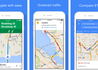
Google Maps update to bring Incognito Mode

If you opt to use it the places which are searched and visited with the help of the app will not be linked to your Google Account. A status icon similar to the one used by the Chrome version of the mode will be visible in the right side of the search bar.

This isn’t the only privacy change that will arrive in the future. Google strived to increase the security and privacy features of Android Q, and it is already known. More privacy will be granted by hiding hardware ID, blocking apps which start in the background and a tighter leash on storage access.

It was also mentioned that Google would change how apps use location. Users will have the option to restrict location access on a per-app basis, and users can pick between three different choices: full access, access is allowed only while the app in use or no access at all. When app access your location data a visible icon will appear in the upper area of the display, allowing users to know that the app tracks them.
A release date wasn’t mentioned, but it is likely that it will surface in the following months.

Categories
News Tech

Google Maps Update Download Available with Improved Features from Waze

We already know that Google is trying to improve Google Maps by getting some features from Waze. Since Google owns Waze, it is a simple and smarter move to do that. So the more information we have on Waze or Google Maps, the more and better users will be informed about the traffic ahead and other obstacles. The novelty on Google Maps is the fact that the company wants to use the same approach from Waze.

What New Features We Have on Google Maps from Waze?

If you are a Waze fun and haven’t tried Google Maps, maybe now is the time to give it a shot. Now Google Maps have speed limits, speed traps, reports about your current traffic experience, and warning about traffic and accidents ahead of you.  The incident report feature will be rolling out soon in Google Maps, and you will see it once the feature will be brought to your market.

However, Google Maps is a great navigation tool for public transport and daily needs. The device will give you suggestions about the fastest route to your destination, will provide navigation details about trains or buses in case you need to change them. The newest improvement is the features were Google Maps will tell you if a train or bus has available seats. This will be done with the help of other users, by asking them if the train/bus is crowded or not. Improving Google’s algorithms with this question, it improves your future journey as well.

Also, if we look back to last year, a similar feature has been announced for Sydney, and this will probably be the case to more markets in the future. So far, the feature has started to appear on Android and on iPhone from months ago. Google Maps is sending alerts on various users from different regions of the world, like the US, Europe, and Asia.

Categories
Games News Tech

Google Maps Has Received A Hidden Game, A Revamped Variant Of “Snake”

Regularly, improvements and new features are always coming to Google Maps because Google consistently updates its navigation app. New navigation functionality is typically added with each update, but this time, users received a hidden game from the tech giant to play on Google Maps. We’re talking about a revamped variant of the classic “Snake” game.

The classic game Snake received a makeover from Google, making it suitable to be played within Google Maps. As April Fool’s Day has just passed, the software now allows you to choose a particular part of the world, as part of the celebration, that you can use as an overlay for the game.

As the character users control, a method of public transport will be used instead of a snake. However, this depends on the city of choice. For example, as if one user’s choice is London, a traditional city bus will be the character. In addition to that, passengers will be collected in the game space instead of pieces of food as in the standard version of Snake.

A revamped version of “Snake” came to Google Maps as a hidden game

Furthermore, the character of the user can grow and boost their score thanks to the landmarks for the location the user has selected and will appear. If you want to give this game a try, you can use the world as a whole or only a city such as Tokyo, São Paulo, Sydney, Cairo, San Francisco, and Cairo.

Google said that “Google Maps shows you how to get around on foot, car, train, and bicycle, and now, you can ‘ssslither’ to your destination too. Starting today [April 1st], you can play a twist on the Snake game in different locations across the world – including Cairo, London, San Francisco, São Paulo, Sydney, and Tokyo – right from Google Maps.”

If you want to travel somewhere, but you are not that sure you will like it, this is an excellent way of finding that out.

Categories
News Tech

Add Public Events on Google Maps: Android Feature Goes Live

For those that use Google Maps regularly, you might have noticed a handy feature that appeared in the Android app.

Google Maps for Android now lets users add a public event in the Contribute Tab. Using Google Maps’ new feature can let business and event managers make public their next events without the need of paying for advertising. It takes nearly 30 minutes to make that event live once it was added on Google Maps.

The new feature is only available for Android users at the moment. Now let’s see how you can set your public event in the short guide below.

Google Maps: Add a Public Event

Looking at the support page from Google, we can see that the feature is not live in all regions, so if you don’t see it, then you’ll have to wait for your region to be added. To see the option and add a public event, follow the next steps:

  • open Google Maps on Android -> go to the tab Contribute -> tap on Events, then tap on Add a public event.

In there, you will get a few choices: you can tag the location, add the event name, and the time and date of the event.

The option also lets you add an image and write more details about the event and even describe it. However, there have been reports of the image option being unresponsive.

Save the event, and if you want, even after you have created the event, you can edit or delete it by going to:

  • Contribute -> Events -> Select your event -> Edit this event / Delete this event.

We don’t know yet if this feature will be globally available or if it will also go live on Google Maps for iPhone users.

Google Maps Changes, New Features and More

According to Debate Report, Google Street View now lets you watch “Mars on Earth,” and it’s definitely not what we expected.

Google has also made a few changes to the Maps for Android, reintroducing city, state and country borders, after being removed a few months ago. When a user searches a city, state or country, they will see the borders highlighted with red. According to reports, this border feature has appeared in version 10.12.1.

Categories
News Tech

How To Find Contacts on Google Maps

Modern technology provides us awesome solutions for every problem. A lot of smartphone users find it difficult to remember addresses or place them on a map. Here is where Google Maps comes in. Apart from directions and support in finding new places, the software allows us to track our contacts easier.

This is possible thanks to the Map My Contact feature. We are talking about an open-source web app which can be used for tracking our Google contacts by using their locations from the world map.

Map My Contacts is operated by a Google script that can spot your contacts’ locations based on their addresses. Besides, if they have their location ON while traveling, you can see which their itinerary is.

It’s easy to Map your contact through Google Maps

The process of locating a Google Contact on the map is fast and easy. All you have to do is follow some simple steps:

  • First, all your Contacts have to be saved in a Google account;
  • Secondly, you’ll have to open the Maps Web App. Here you need to Authorize the Script, but the process also requires permission to use Google Drive;
  • Once the mentioned script is authorized, the app will start processing your Contacts list;
  • Finally, you’ll see a Google Map with you Contacts generated as HTML file.

You don’t have to worry about safety and security when you are using Map My Contacts. The information obtained through the app will only be available to every particular person. In our case, you will be the one who has access to the data.

Map My Contacts is a fun and versatile app which can be used even when Google Contacts are not primary. Also, people can export the information for locating their friends from all over the world.

Exit mobile version